All Construction

Favorite
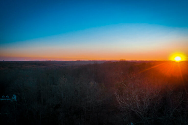
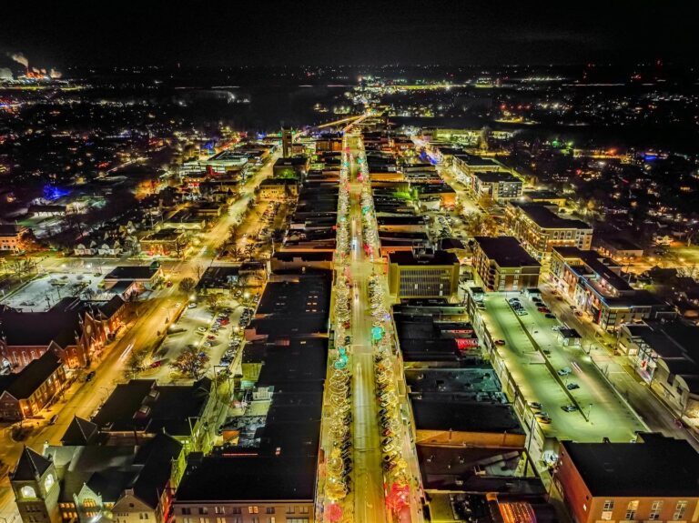
Address: Phoenix
Phoenix
Arizona
Phoenix
Arizona
Discover the power of aerial imagery with iSky Films. As a leading provider of drone photography and videography services, we specialize in capturing stunning aerial footage for a wide range of clients. From commercial real estate and construction to automotive events and solar projects, our team delivers high-quality aerial images and videos that elevate your brand and showcase your vision. Read more...
Favorite
Address: Perkiomenville
Perkiomenville
Pennsylvania
Perkiomenville
Pennsylvania
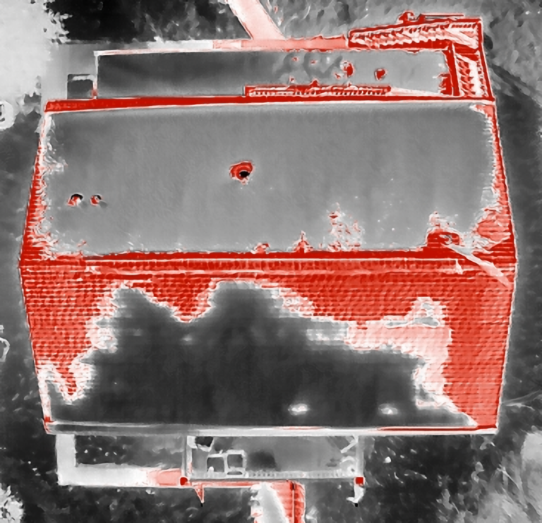
Owner/Operator – Licensed 107 Pilot – Aerial Services, LLC Specializing in thermal imaging & data collection. Other services provided include 3D modeling/mapping, asset inspection (antenna/infrastructure); as well as emergency response services. Full professional reports and thermal R-JPEG images provided with all services. With 10 years of UAV experience, Aerial Services, LLC is fully FAA licensed and insured. Read more...

Favorite
Address: Philadelphia
Philadelphia
Pennsylvania
Philadelphia
Pennsylvania
Bearing Witness Images was born out of a dream to turn an interest into an investment. Being able to see the world from previously unimaginable angles and perspectives fascinated me and spurred me to learn more about this technology and its potential uses. My goal is to use my skills to bring a whole new perspective to your vision. Whether Read more...

Favorite
Address: Kissimmee
Kissimmee
Florida
Kissimmee
Florida
Experienced Part 107 FAA Licensed Drone Pilot providing Aerial Photography and Mapping Services in Central Florida. Operating a DJI Phantom 4 Pro V2, I am fully compliant with Remote ID FAA requirements. For all your Drone Photography needs, feel free to reach out and elevate your projects with precision and expertise! *Please note the quality of pictures uploaded are low Read more...
Favorite
Address: Private Address
Started keeping a verifiable electronic flight log in December of 2015 using Drone Logbook with over 460hrs currently logged. I have flown in many different conditions and situations. I Began with toy grade drones and quickly moved on to building my own: 450mm 4S quad, 550mm 4S hex, 680mm 4S hex, 550 6S quad. I eventually purchased a fleet of Read more...
Favorite
Address: Basehor
Basehor
Kansas
Basehor
Kansas
Proven reliability drone mapping, and photogrammetry. I work for Atlas Land Consulting as a drone pilot and CAD technician. We have performed and executed many projects with drones and are always looking for new clients to work with! We hope to hear from you! Read more...
Favorite
Address: Montville
Montville
New Jersey
Montville
New Jersey
Introducing Andrew Waring, Your Aerial Imaging Specialist! 📸 About Me: I’m Andrew, your trusted drone operator, ready to capture stunning photos and videos from the skies for a variety of needs. 🏡 Real Estate: Elevate your property listings with breathtaking aerial shots. I specialize in showcasing homes from a unique perspective that will leave potential buyers in awe. 🎉 Events: Read more...
Favorite
Address: Lansdale
Lansdale
Pennsylvania
Lansdale
Pennsylvania
Over 20 Years of Aviation Experience – FAA Licensed Pilots – Insured Read more...
Favorite
Address: 9530 W State Rd 48
Bloomington
Indiana
Bloomington
Indiana
At Black Sky of Indiana Drone Solutions, our mission is to provide high-quality drone photography and video services to our clients. We value safety, professionalism, and creativity in all of our projects. We want to partner with you. We serve Bloomington Indiana and the surroumding counties. Read more...
Favorite
Address: Sidney
Sidney
Nebraska
Sidney
Nebraska
High Point Images provides professional aerial photography and videography in Nebraska, Colorado, and Wyoming. I specialize in drone photography and videography across many industries. I am an FAA Part 107 certified pilot and have been in business since 2019. Contact me today to learn more about how I can help tell your story from a High Point of view. Read more...
Favorite
Address: Fredericksburg
Fredericksburg
Virginia
Fredericksburg
Virginia
We are a small, locally-owned business that is proud to serve the Fredericksburg, Virginia area with top-quality drone services. We are committed to delivering exceptional service to our clients, whether we are capturing breathtaking aerial footage for a real estate listing, providing 3D mapping for a construction project, or streaming a corporate event live. At Twelve Nineteen Drone Services, we Read more...
Favorite
Address: Salina
Salina
Utah
Salina
Utah
I am a very experience and qualified drone operator here in central Utah, but more importantly I absolutely love flying drones. I’ve been flying and operating drones for nearly 10 years, I’ve worked with many notable state and local government agencies including the Utah Bureau of Land Management, the United States Forest Service, and the Utah State Historic Preservation Office. Read more...
Favorite
Address: Albuquerque
Albuquerque
New Mexico
Albuquerque
New Mexico
United Aerial Service LLC is your premier destination for high-precision Aerial Photography, Aerial Videography, Drone Surveying, and Drone Inspections across the United States. Our team of FAA Licensed pilots combines expertise with state-of-the-art technology to deliver professional and on-time results. Whether you’re in real estate, construction, or mining, we help you see the bigger picture, from above. Explore the endless Read more...
Favorite
Address: East York
East York
Pennsylvania
East York
Pennsylvania
Mark Raybin is a Part 107 Certified sUAS Drone Pilot with over 15 years of photography and videography experience. He also has experience with getting LAANC (Low Altitude Authorization and Notification Capability) air approval and part 107 waivers (allow up to 90 days for approval in some cases dependent upon flight location). SOME OF THE INDUSTRIES WE HELP SUPPORT: Emergency/Disaster Read more...
Favorite
Address: Horace
Horace
North Dakota
Horace
North Dakota
Since 2016, we have provide drone service solutions for hundreds of wide-ranging clients in the upper Midwest. Our approach has been to provide first-class aerial photography for clients while keeping the project affordable and timely. Read more...

Favorite
Address: Garden Grove
Garden Grove
California
Garden Grove
California
I specialize in real estate, events, and advertisements, but I am willing and eager to branch out into other fields such as TV/Film, inspections, site surveys, and agriculture. I communicate very closely with my clients to ensure I give them exactly what they’re looking for and the best service possible. I live in Orange County California, but I am very Read more...
Favorite
Address: Lawrence
Lawrence
Kansas
Lawrence
Kansas
Aerial Photography & Videography ~📲Content Creation ~🧐Aerial Inspection ~🏡Real Estate ~🍾Special Events in Lawrence, KS & Beyond Read more...
Favorite
Address: Fort Lauderdale
Fort Lauderdale
Florida
Fort Lauderdale
Florida
Experience the unparalleled capabilities of drone mapping and aerial photography services offered by Drone Worx. Unlock new opportunities, gain a competitive edge, and showcase your assets like never before. Contact us today to discuss your project, and together, we’ll take your vision to new heights. We Offer: – Aerial Photography / Videography – Photogrammetry / Orthomosaics – 3D Models / Read more...
Favorite
Address: Chadds Ford
Chadds Ford
Pennsylvania
Chadds Ford
Pennsylvania
My name is Thomas H. Vickers IV and I am a Commercial Drone Pilot in the Philadelphia region. I specialize in Real Estate Drone images and videos as well as local events, homes, and commercial properties. Read more...
Favorite
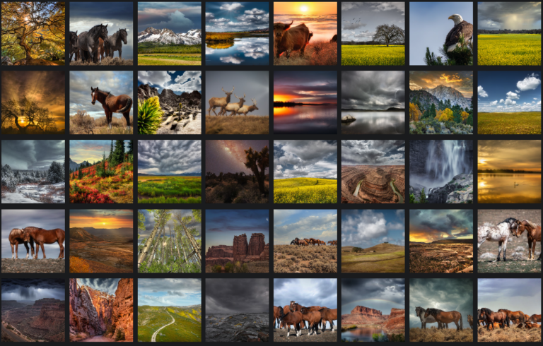
Address: Private Address
Tracy Rose (707) 364-3862 Website: https://www.tracyrosenaturephotography.com Drone Videography: https://www.tracyrosenaturephotography.com/Videos Summary: Highly skilled and accomplished drone pilot with FAA PArt 107 certification and a diverse background in both commercial and private sectors. With a passion for cutting-edge technology and aerial photography, I have consistently demonstrated exceptional proficiency in operating drones and delivering exceptional results. Leveraging a wealth of experience across various Read more...